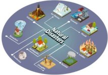
Computer graphics have emerged as a powerful tool in simulating natural disasters, offering scientists, urban planners, emergency responders, and the general public a dynamic way to visualize and understand the devastating impact of events such as earthquakes, tsunamis, floods, and hurricanes. With high-resolution 3D graphics, advanced modeling software, and real-time data integration, these simulations play a crucial role in disaster preparedness, response planning, and post-disaster analysis.
The foundation of natural disaster simulation lies in the ability of graphics software to recreate complex environmental phenomena with scientific accuracy. By combining satellite imagery, geographic information system (GIS) data, and physics-based models, researchers can generate lifelike animations of potential disaster scenarios. For example, a tsunami simulation can depict how waves travel across oceans, interact with coastlines, and flood inland regions—all within a virtual model that mirrors real-world geography.
One of the most critical applications of computer graphics is in earthquake simulations. Using seismic data and fault line analysis, scientists can model how an earthquake would affect urban infrastructure, bridges, and roads. These 3D visualizations can predict how shockwaves will move through different types of terrain and what buildings are most at risk of collapse. Such information helps architects and engineers design more resilient structures and allows city officials to plan effective evacuation routes.
Similarly, flood simulations are widely used in flood-prone areas. Graphics tools allow meteorologists and hydrologists to simulate rainfall accumulation, river overflow, and drainage capacity in real-time. These simulations can project the spread of water in urban and rural settings, enabling local governments to issue early warnings and deploy resources efficiently. Tools like HEC-RAS and ANUGA are often used to render flood models with detailed visualization.
Computer graphics also support hurricane and tornado simulations, showing wind patterns, rainfall intensity, and potential damage paths. These graphics help the public understand the scale of the threat and prepare accordingly. Emergency management teams use these visuals in training programs to simulate disaster scenarios, test response strategies, and improve coordination between agencies.
Beyond real-time applications, disaster simulations are essential for educational and awareness campaigns. By visualizing disaster scenarios in schools, communities, and online platforms, the public can gain a better understanding of how disasters unfold and what actions to take during emergencies. These animations can depict “what if” situations—such as a major earthquake in a metropolitan area or the consequences of a dam break—prompting proactive thinking and preparedness.
Moreover, in the aftermath of disasters, graphic simulations help researchers reconstruct events for forensic analysis. By inputting sensor data and eyewitness accounts, software can recreate how a disaster unfolded, aiding in damage assessment, insurance claims, and recovery planning.
Despite the benefits, challenges exist. Accurately modeling disasters requires enormous computational resources, reliable real-time data, and interdisciplinary expertise. Weather variability and unpredictable geological behavior also introduce uncertainties into simulations. However, as AI and machine learning continue to integrate with graphics tools, these simulations are becoming more accurate, adaptive, and accessible.
In conclusion, computer graphics are revolutionizing how we understand, prepare for, and respond to natural disasters. Through powerful visualizations and realistic simulations, they transform raw data into actionable insights, saving lives and resources in the process. As climate change increases the frequency and intensity of extreme events, the role of computer graphics in disaster management will only become more vital.
Join the Conversation:
Have you ever seen a disaster simulation that changed how you think about safety?
Do you believe simulations can help save lives during real emergencies?
What natural disaster do you think needs more graphic-based research?
Let us know your thoughts in the comments!